OS Maps Premium subscription
- Score 4/5
- Website www.ordnancesurvey.co.uk
- Price £25.99/year or £3.99/month
- Operating system Android & iOS
- Display N/A
- Touchscreen N/A
- Sensors N/A
- Water resistant N/A
- Battery life N/A
- Dimensions N/A
- Weight N/A
- Region Great Britain
- Maps included Full range of OS leisure maps
- Offline use Yes
- Devices Smartphone, tablet and computer
- Phone GPS compatible Yes
- Discover routes Yes
- Free trial Yes
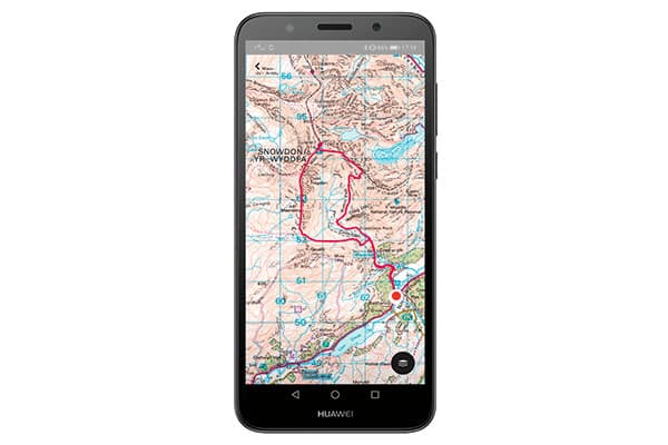
Ordnance Survey is best known for its paper maps but its digital offering is extremely well known and highly respected. This makes the OS Maps smartphone app and website with a Premium subscription from the national mapping agency in the UK an obvious port of call for many people.
The OS Maps app is free to download, and the free version provides standard, greenspace and aerial mapping of Great Britain while you have a data connection. If you plan on heading off the beaten track where mobile signal may be sporadic, the Premium subscription at £25.99 per annum is a must.
With the Premium option you get OS explorer 1:25,000 and OS Landranger 1:50,000 maps, which allows you to download sections of Great Britain. You can’t, however, download the entire GB map so you have to select smaller areas such as the north Lake District and the south Lake District as two maps. Downloaded maps remain available on your device even after the subscription ends.
One of the great features of the OS Maps app is that if you purchase an OS explorer or Landranger paper map, there will be a code included so you can download a digital offline version of the map to your smart device. Both digital downloads using map codes or the Premium subscription allow you to import, record and export GPX route files so you can follow predefined routes when out in the field. Alternatively, simply using GPS will pinpoint your current location.
The OS Maps app is easy to use and the ability to download such a wide range of map types in a single download for offline use makes it a convenient option. Viewranger, conversely, requires you to download OS Landranger, Explorer and Satellite maps separately. The ability to import and export GPX files for routes is also an excellent feature.
ViewRanger Premium +OS maps
- Score 5/5
- Website www.viewranger.com
- Price £24.98/year
- Operating system Android & iOS
- Display N/A
- Touchscreen N/A
- Sensors N/A
- Water resistant N/A
- Battery life N/A
- Dimensions N/A
- Weight N/A
- Region Great Britain
- Maps included OS Landranger (1:50k) and Explorer (1:25k) maps
- Offline use Yes
- Devices Smartphone, tablet, computer and Google Wear OS smartwatches
- Phone GPS compatible Yes
- Discover routes Yes
- Free trial Yes
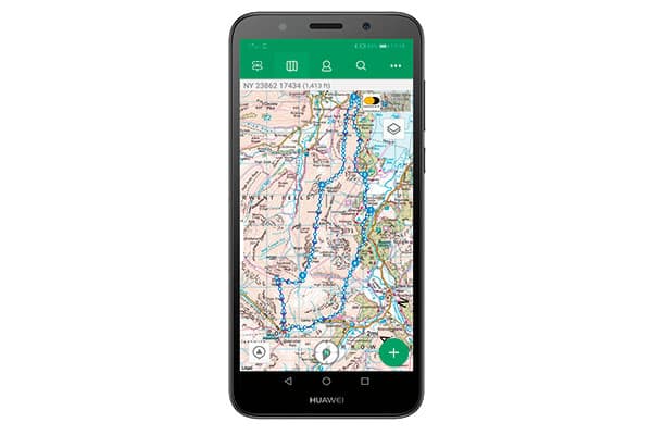
Offering a similar proposition to OS Maps comes ViewRanger: a digital mapping option that provides worldwide maps in a range of subscriptions through its app and website. The app is free and a number of maps can be used for free when you have mobile data signal.
The ViewRanger Premium + OS maps for Great Britain provides a wealth of offline mapping options including a Great Britain overview Map, alongside more detailed maps of smaller areas that can be selected and downloaded in the same way as OS Maps. At £24.98 per annum, the cost is almost identical to OS Maps, but the inclusion of the Great Britain overview Map and Great Britain road Map is a useful and convenient bonus. The downside is that when you download an area using either the OS Landranger (1:50k) and Explorer (1:25k) maps, if you’d like a different type of map, such as a satellite view for the same area, you have to download it separately.
ViewRanger also provides user-created routes that can be downloaded from within the app itself, and if you don’t have the offline map already you can choose to download both together which is a truly amazing feature. Routes are created by individuals, organisations and outdoor magazines who can be followed within the app. You can also import GPX files using the website when logged into your account, or through the app itself. Plus, you can record your own routes which can be exported as GPX files using the website since everything in your account syncs.
The ViewRanger Premium + OS maps for Great Britain is a well-thought-out app that provides a wide range of maps and tools to help you to navigate your way around the country. Additional worldwide and country-based maps can also be purchased, so if you’re travelling abroad with your photography you can continue to use the navigation app that you know and trust.
Garmin eTrex 20x
- Score 3/5
- Website www.garmin.com
- Price £140
- Operating system Garmin
- Display 2.2in transflective
- Touchscreen No
- Sensors GPS receiver with HotFix and GLONASS support
- Water resistant IPX7
- Battery life Up to 25 hours
- Dimensions 5.4 x 10.3 x 3.3cm
- Weight 141.7g with batteries
- Region Western European
- Maps included Garmin TopoActive map of Western Europe
- Offline use N/A
- Devices N/A
- Phone GPS compatible N/A
- Discover routes N/A
- Free trial N/A
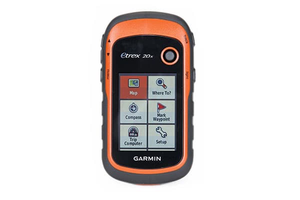
If you’re looking for a standalone GPS navigation device offering a longer battery life than a smartphone, the Garmin eTrex 20x is an entry-level option that’s small enough to fit in your pocket and runs on AA batteries. This means you don’t have to worry about charging on longer trips, and spare batteries can easily be carried and purchased when required.
The eTrex comes preloaded with the Garmin TopoActive map of Western Europe, which is routable, shows elevation, and is ideal for both hiking and cycling. But it lacks the depth of detail you can enjoy using OS Maps which are available for purchase from the Garmin website. Buying the TOPO Great Britain Pro 1:50k for £150 (OS Maps) would seriously improve your experience, but at a cost.
There are other maps available from Garmin that are less expensive, so if you’re interested in this device it’s worth having a look at the Garmin website to see exactly what’s available. You can also download free topographic maps that can be easily found with an online search. There’s 4GB of internal storage, and if you need more space there’s a micro SD slot, too.
To plot routes and load them into the device, Garmin provides BaseCamp: a free software for Mac and Windows. There are other features the software offers, but this is the one that’s most useful for photographers planning a trip.
The eTrex can provide sunrise, sunset, moonrise and moonset information alongside moon phase, which can be checked using a calendar allowing you to plan days, weeks or months ahead. It’s not as advanced as some other apps available for smartphones though.
The Garmin eTrex is a compact, lightweight and cost-effective GPS unit, but it’s far from perfect. The screen is low resolution compared to the Satmap Active 20 and smartwatches in the test, and is also more difficult to view in bright light, but this is made up for by its size and weight, which is less than that of the Satmap.
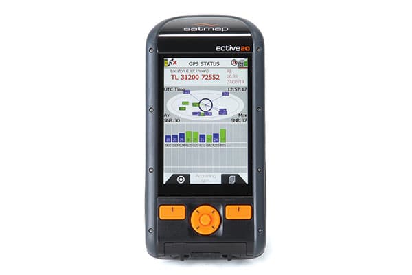
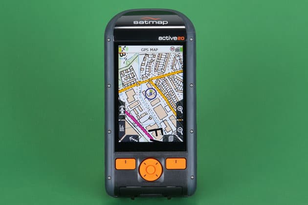
Satmap Active 20 GB Edition 50K
- Score 5/5
- Website www.satmap.com
- Price £480
- Operating system Satmap
- Display 3.5 HVGA high-res TFT
- Touchscreen Yes
- Sensors GPS/GLONASS/Galileo, barometric altimeter
- Water resistant IP68 and submergible up to 1.5m
- Battery life Up to 16 hours
- Dimensions 3.5 x 7.1 x 14.7cm
- Weight 310g with batteries
- Region World
- Maps included World base mapping + other options available
- Offline use N/A
- Devices N/A
- Phone GPS compatible N/A
- Discover routes N/A
- Free trial N/A
If you require a GPS solution for planning and navigating your landscape photography trips, the Satmap Active 20 GB Edition 50K is a serious bit of kit. It provides a robust build for all-weather use and a high-resolution, bright screen for detailed mapping that’s easy to view.
The option reviewed here includes OS Maps Full GB 1:50k Landranger, but you can also purchase the unit without OS Maps included (world base mapping is preloaded in all devices) with the option to purchase smaller map areas as well as maps for international destinations. There are more expensive editions that provide even more detailed maps, so you have some flexibility in terms of price and map detail. And as you’d expect, you can also plan routes and record trails.
With a large Gorilla Glass touchscreen and navigation buttons, the device can be used both with and without gloves to provide ease of use regardless of the weather. This device is essentially a handheld computer dedicated to navigation, which makes it smooth in use, and Wi-Fi connectivity allows for easy updates. It’s not a GPS unit that you can simply take out of the box and use without reading the quick- start guide, but this short document provides all the information you need to get started.
Of particular interest to those who regularly undertake multi-day trips into the wilderness, the Active 20 provides up to 16 hours of use on a single charge. The unit comes with a rechargeable battery and can be charged from the mains or a battery pack via USB. An AA battery caddy can also be purchased, making this arguably the most versatile option in terms of power in the test. The Satmap Active 20 is clearly aimed at the outdoor enthusiast who requires a robust and long-lasting power in a GPS unit. And while the price point won’t appeal to all, for photographers who spend much of their time in the outdoors and off the beaten track, this device is hard to beat.
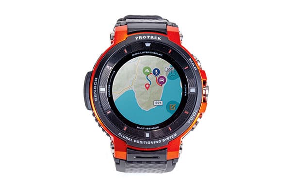
Casio WSD-F30
- Score 5/5
- Website www.casio.com
- Price £450
- Operating system Wear OS by Google
- Display 1.2in colour OLED and monochrome LCD
- Touchscreen Yes
- Sensors GPS/GLONASS/and Michibiki, Pressure (air pressure, altitude) sensor, accelerometer, gyrometer, compass
- Water resistant Up to 5 bar
- Battery life Up to 1.5 days with all features on
- Dimensions Approx 60.5 x 53.8 x 14.9cm
- Weight 83g (including wristband)
- Region World
- Maps included Google Maps included and ViewRanger compatible
- Offline use N/A
- Devices N/A
- Phone GPS compatible N/A
- Discover routes N/A
- Free trial N/A
Smartwatches are continually improving to offer a wider variety of uses, and the Casio WSD-F30 is a smartwatch that’s designed for outdoor use with a range of features that make it ideal for navigation in the great outdoors.
Getting it set up requires installation of the Wear OS by Google app, which is available for both Android and iOS. Set up takes around five minutes and once completed you can enjoy the features and functionality you’d get with the majority of modern smartwatches.
The previous version of the WSD-F30, the WSD-F20, came bundled with ViewRanger Maps and a year’s subscription which was a great partnership, but this new version comes with only Google Maps included. If you require more detailed mapping, the ViewRanger app for Wear OS is compatible and looks fantastic even on the small OLED screen.
By default, the Map button which is one of three on the watch is set to access Google Maps, but if you prefer to use ViewRanger you simply have to install the app from the Google play store and reassign the button. With just three buttons, controlling it is relatively simple.
Being a small and lightweight device that you wear on your wrist makes the WSD-F30 a convenient navigation device, but with this comes a small battery that Casio says will last up to 1.5 days with all features turned on. In reality, this is closer to a day, and the watch has to be removed from your wrist to charge it. The watch comes with some effective modes to increase battery life and switches from colour to monochrome when you’re not looking at it.
The WSD-F30 looks like a Casio G-shock watch and inherits the rugged attributes this product line is well known for. It’s comfortable and provides plenty of features to make it a great everyday smartwatch as well as a convenient navigation device. Battery life is the biggest negative, but as long as you can charge it at the end of the day you’ll have no issues.
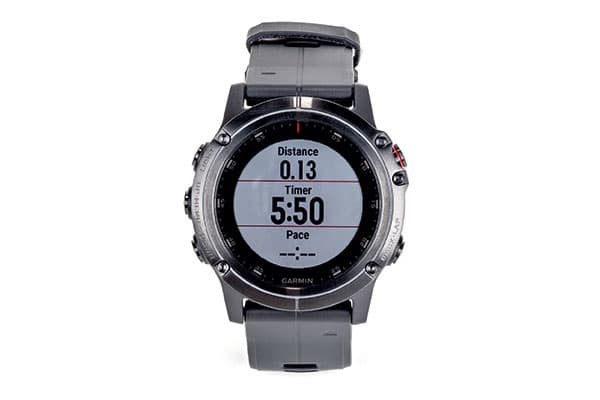
Garmin Fēnix 5X Plus
- Score 4/5
- Website www.garmin.com
- Price £599
- Operating system Garmin
- Display 1.2in sunlight-visible, transflective memory-in-pixel
- Touchscreen No
- Sensors GPS/GLONASS/Galileo, heart rate monitor, compass, barometric altimeter, gyroscope, accelerometer, thermometer, Pulse Ox
- Water resistant 10 ATM
- Battery life Up to 32 hours with GPS
- Dimensions 51 x 51 x 17.5cm
- Weight 96g
- Region Europe
- Maps included TopoActive Europe map
- Offline use N/A
- Devices N/A
- Phone GPS compatible N/A
- Discover routes N/A
- Free trial N/A
Multi-sport smartwatches are becoming increasingly popular as many people wish to track their daily lives, sleep and exercise. The Garmin Fēnix 5X plus is a smartwatch that, like the Casio, does many things you’d expect from a smartwatch, but with the added bonus of features including a heart-rate monitor.
The watch is aimed more towards fitness and lifestyle tracking, but with impressive battery life when using GPS and the built-in full-colour TopoActive Europe map, it’s an alternative to watches running Wear OS by Google.
The watch is set up and connects to your smartphone with the Garmin Connect app. There are a large number of apps available including one that allows you to navigate using Google Maps and import GPX files, so there’s plenty of room to expand the capabilities of the watch. Other maps are available for purchase from the Garmin website.
When navigating using the built-in mapping, inputting coordinates is the easiest way to locate your final destination. You can use the map to find your destination, but employing the buttons to zoom in and out of the map and to move horizontally and vertically is clunky and really quite difficult. With coordinates, you will need the longitude and latitude of the location so it’s not perfect. This is where a touchscreen interface would make a huge difference and make this a much easier task.
When it comes to fitness wearables and navigation devices, Garmin is one of the major players in the market and the Fēnix 5X plus certainly lives up to what you’d expect from a high-end multi-sport wearable with GPS and navigation. At £599 it’s the most expensive device in the round-up, but it also provides the widest range of features including a battery life that’s considerably better than that of the Casio WSD-F30. When it’s used in GPS/mapping mode the battery can last for up to 32 hours, and up to 20 days just as a smartwatch.

